


در آزمون رایتینگ آیلتس ممکنه از شما خواسته بشه که نقشه ای رو در تسک 1 توضیح بدین. و به نظر من ساده ترین سؤال برای گرفتن نمره ی بالاست.
بسیاری از داوطلبای آیلتس، به این نوع سوال کم توجهی میکنن.
Different Kinds of Map Question |
|

There are three main types of map question:
- Describe one map in the present day.
- Describe two maps- one in the present and one in the future.
- Describe two maps- one in the past and one in the present.
نوع اول بسیار نادره، چون فقط شما فقط باید از present simple استفاده کنین و امکان مقایسه وجود نداره.
نوع دوم بیشتر از نوع اول در آزمون ها هست و از شما می خواد که از زمان حال و آینده استفاده کنین. این نوع سؤال معمولاً در مورد آینده یک شهر یا یک منطقه هست.
اما مورد سوم رایج ترین نوع سوال هست و تمرکز ما تو این متن روی همین دسته هست.
You will normally be shown two maps, as above and asked to select and report the main features, and make comparisons where relevant. You will obviously be using both present and past tenses to describe the maps and how the town has developed.

Structure
| Paragraph 1- Paraphrase Sentence |  |
Paraphrase question using synonyms.
| Paragraph 2- Overview | |
Make two general statements about the map. You should describe the maps generally and write about the most noticeable differences between the two maps.
برای مقایسه دو نقشه باید سوالات زیر و از خودتون بپرسین:
Is the map more or less residential? Is there more or less countryside? Are there more or less trees? Were the changes dramatic or negligible? Were there any major improvements in infrastructure? How have the buildings and leisure facilities changed?
|
Paragraph 3- Main Body 1 |
|
سه تا چهار جمله در مورد تغییرات خاصی که رخ داده.
| Paragraph 4- Main Body 2 | |
Further three to four sentences about specific changes that have occurred.
You can group information together in paragraph 3 and 4 by time or location, depending on the question asked.
توانایی این که راجع به تغییرات بتونین صحبت کنین تو این نوع سوالا بیشتر از همه چی به دردتون میخوره.
چیزی که مهمه اینه که بلد باشین چجوری تغییرات اونارو از گذشته به حال یا آینده توصیف کنین.
Example
Sample Essay
 |
|
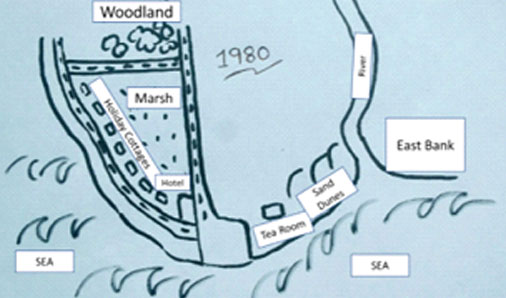 |
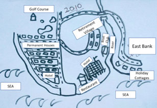
The maps illustrate significant changes in the seaside town of Seaville, over a thirty-year period, from 1980 to 2010.Overall, the village developed substantially from a holiday settlement to a permanent town over the 30 year period. Similarly, infrastructure and amenities increased, along with the town’s capacity to provide for tourists.
In 1980, Seaville was tiny, attracting only a few tourists, who were accommodated in cottages or a small hotel. In contrast, East Bank was unspoilt. To the east of the cottages, was a marsh, and there was woodland to the north. Regarding recreation, besides the beach, the town only offered a tea room.
However, the village had grown dramatically by 2010. Retirement villages had been built to the west of the main road. The marsh had been drained and the cottages demolished in order to construct houses. To cater for tourists, both a new high-rise hotel and holiday cottages on East Bank had been constructed.bank of the river. New infrastructure was created to access East Bank. On the other hand, the town had preserved the original hotel.
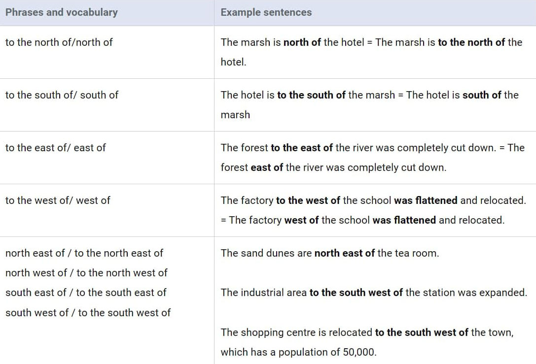
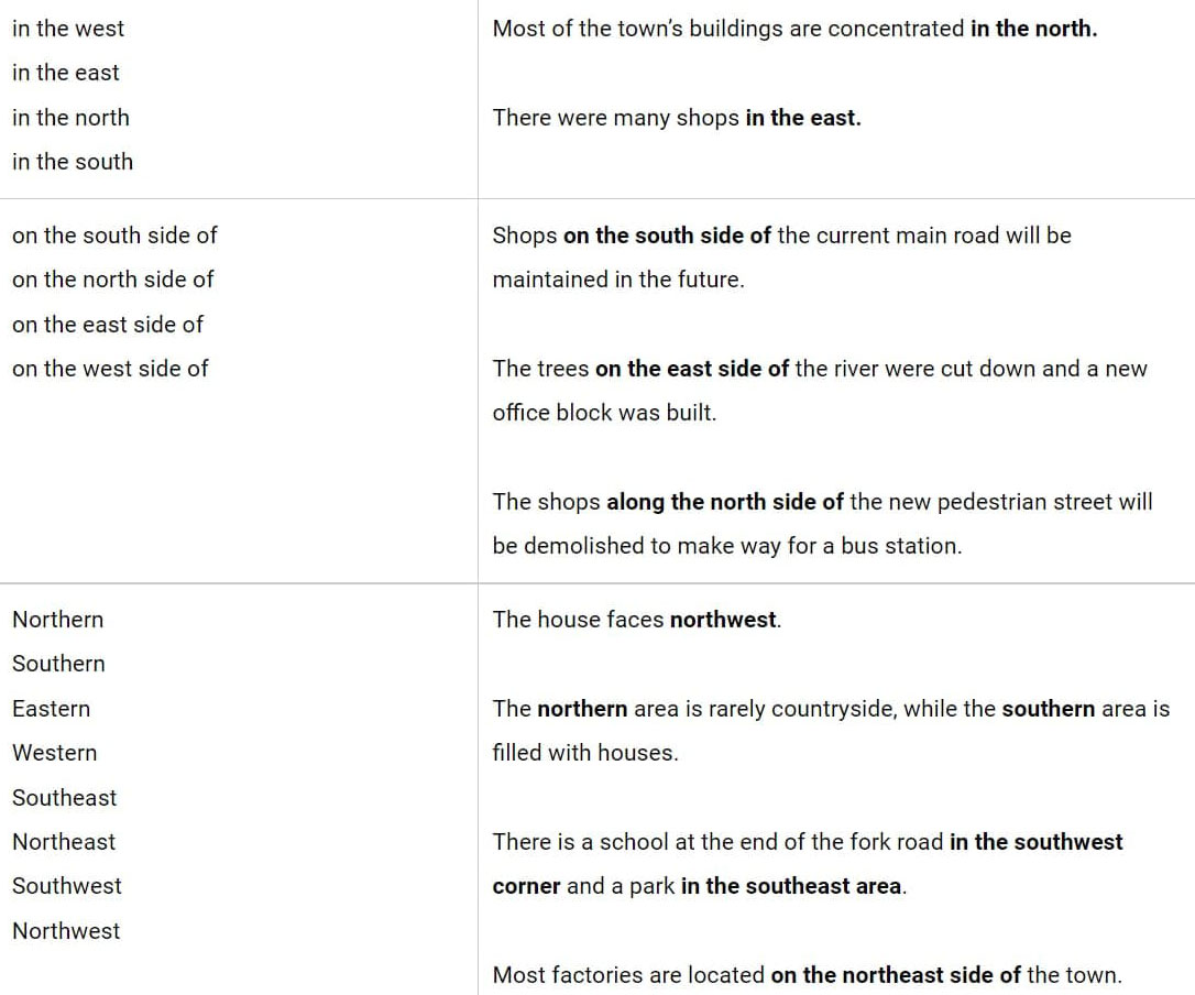
Vocabulary for IELTS Academic Writing Map Questions